Thailand’s Most Scenic Viewpoints: 10 Unforgettable Views Worth Experiencing
Thailand’s landscapes can look completely different when seen from above. Mountain ridges rise through early-morning mist in the north, limestone peaks break through wetlands and tropical forests, while viewpoints in the south reveal sweeping coastlines, islands and bays scattered across impossibly blue water.
But the most memorable Thailand scenic viewpoints are about more than the view itself. Sometimes the experience means setting out before sunrise, hiking through forest or climbing a mountain trail. Elsewhere, it might involve camping above the clouds, stepping onto a glass skywalk or simply pulling off a coastal road and discovering an extraordinary panorama almost immediately.
For this guide, we have chosen 10 of Thailand’s most scenic viewpoints for the experiences they offer as much as the landscapes they overlook. They are not ranked from best to worst, nor are they simply the highest or most photographed places in the country. Each reveals something different about Thailand, from the mountains and Mekong landscapes of the north and northeast to national parks, rainforest, tropical islands and the limestone formations of the Andaman coast.
Some require considerably more effort than others, but that is part of their appeal. Whether you want to watch Thailand’s first light, wake above a sea of mist, earn a spectacular panorama on foot or find an unforgettable view without a demanding hike, these are viewpoints worth considering as you explore Thailand.
Quick Summary: Thailand Scenic Viewpoints
Thailand’s most memorable viewpoints offer very different experiences. Some are worth an early start for sunrise and mist, others reward a challenging hike, while several provide extraordinary panoramas with surprisingly little effort.
Rather than asking which has the single “best” view, use this quick comparison to find the viewpoint experience that best fits your trip.
| Viewpoint | Province | Best For | Best Time | Effort |
|---|---|---|---|---|
| Phu Chi Fa | Chiang Rai | Mountains and sea of mist | Sunrise | Moderate |
| Pha Chana Dai | Ubon Ratchathani | Thailand’s first light | Sunrise | Moderate |
| Khao Takhian Ngo | Phetchabun | Camping above the mist | Sunrise | Easy–Moderate |
| Khao Daeng | Prachuap Khiri Khan | Karsts, wetlands and coastline | Early morning | Moderate |
| Khao Ngon Nak | Krabi | Hiking for an Andaman panorama | Early morning | Challenging |
| Samet Nangshe | Phang Nga | Limestone islands of Phang Nga Bay | Sunrise | Easy–Moderate |
| John-Suwan | Surat Thani | Tropical island panorama | Morning | Moderate |
| Karon Viewpoint | Phuket | Easy-access coastal scenery | Morning–Late afternoon | Easy |
| Aiyerweng Skywalk | Yala | Rainforest, mist and skywalk | Sunrise | Easy |
| Hin Sam Wan | Bueng Kan | Sandstone formations and Mekong landscape | Sunrise | Moderate |
Also worth experiencing: Pai Canyon in Mae Hong Son for sunset across its sandstone ridges, Noen Nang Phaya in Chanthaburi for a scenic coastal-road panorama, and Phu Thok in Loei for morning mist during a visit to Chiang Khan.
What Makes a Viewpoint Worth Experiencing?
A spectacular view is only part of what makes a viewpoint memorable. Across Thailand, there are countless places where you can look across mountains, beaches, islands and cities, but the viewpoints that stay with you often have something more — an experience that gives the landscape context.
That might mean arriving at Phu Chi Fa before dawn to watch mountain peaks emerge through the mist, hiking through tropical forest to reach the viewpoints of Khao Ngon Nak, or spending the night at Khao Takhian Ngo so you can wake above the clouds. At other places, accessibility is part of the appeal. Karon Viewpoint in Phuket proves that an extraordinary panorama doesn’t always have to be earned through hours of hiking.
For this guide, we looked beyond simply choosing Thailand’s highest, most famous or most photographed viewpoints. Instead, each selection offers a distinctive combination of landscape, location and experience.
The result takes us across very different parts of Thailand: mountain ridges overlooking Laos, the Mekong frontier, mist-covered valleys, limestone wetlands, tropical rainforest, islands and the dramatic karst scenery of Phang Nga Bay.
Some viewpoints are destinations in their own right, while others make more sense as part of a wider journey through a national park, island or region. What connects them is simple: sometimes the journey to a viewpoint — and the moment you experience when you arrive — can be every bit as memorable as the view itself.
Phu Chi Fa, Chiang Rai — Stand Above the Clouds at Sunrise
High in the mountains of Chiang Rai, Phu Chi Fa offers one of Thailand’s classic sunrise experiences. The viewpoint sits at around 1,628 metres above sea level, close to the border with Laos, where a dramatic cliff projects towards the valleys and mountains beyond.
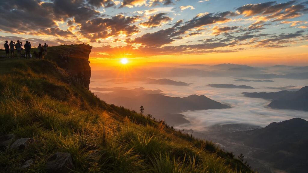
The reason to come, however, is not simply the elevation. Arrive before dawn and the landscape can be hidden beneath darkness and cloud, before the first light gradually reveals mountain ridges rising through a vast sea of mist. TAT continues to identify Phu Chi Fa as one of Thailand’s standout sunrise and mist viewpoints.
What Makes Phu Chi Fa Special
Phu Chi Fa gives you the feeling of standing on the edge of Thailand. From the high ridge, the landscape stretches away across the mountainous border region towards Laos, with successive peaks disappearing into the distance.
When conditions are right, mist fills the valleys below while the higher ridges remain visible above it. As sunrise begins to colour the sky, the landscape changes almost minute by minute.
It is this combination of altitude, mist, mountains and first light that earns Phu Chi Fa its place among Thailand’s most scenic viewpoints. You are not simply stopping somewhere to admire a panorama; getting there before sunrise and watching the landscape slowly appear is the experience.
Best Time to Experience Phu Chi Fa
Phu Chi Fa can be visited throughout the year, but the cooler months are particularly popular for mountain scenery and morning mist. TAT highlights the end of the year as an especially beautiful period, while January is among the country’s prime months for northern mountain trips and sea-of-mist experiences.
Sunrise is the time to aim for, which means arriving at the viewpoint while it is still dark.
A sea of mist can never be guaranteed. Temperature, humidity, rainfall and wind all influence what you will find when you reach the ridge. Even without a perfect blanket of cloud, however, sunrise across the surrounding mountain ranges remains the principal reason for making the early start.
Getting There and What to Expect
Phu Chi Fa is in Thoeng district in eastern Chiang Rai Province, well away from Chiang Rai city itself, so this is an experience worth planning rather than treating as a casual morning excursion.
Most visitors stay closer to Phu Chi Fa the night before and make the final journey before dawn. During busy periods, access arrangements can change; for the 2025–26 high season, park authorities introduced controls on private vehicles and shuttle services to manage congestion and improve safety.
From the upper access area, you still need to continue on foot towards the viewpoint. Bring suitable footwear and something warm during the cooler months — temperatures in the mountains before sunrise can feel remarkably different from the Thailand many travellers associate with tropical beaches.
A torch or phone light is also useful for the pre-dawn approach.
Combine Your Visit With Chiang Rai
Phu Chi Fa works particularly well as part of a wider exploration of eastern Chiang Rai rather than a hurried return trip from the city.
The region contains several other mountain viewpoints, including Doi Pha Tang and Phu Chi Dao, while Chiang Rai Province itself combines mountainous scenery with temples, Lanna culture, hill communities and landscapes along the Mekong.
Give yourself time and Phu Chi Fa becomes more than somewhere to photograph sunrise. The journey into the mountains, the cold pre-dawn start and the wait for the landscape to reveal itself are all part of experiencing one of northern Thailand’s most memorable viewpoints.
Pha Chana Dai, Ubon Ratchathani — Experience Thailand’s First Light
There are plenty of places in Thailand where getting up before dawn rewards you with a beautiful sunrise. Pha Chana Dai offers something a little more meaningful: the chance to watch a new day begin from the far eastern edge of the country.
Located within the Dong Na Tham forest of Pha Taem National Park in Ubon Ratchathani, the sandstone cliff looks east across the Mekong border landscape towards Laos. Pha Chana Dai is widely associated with Thailand’s earliest sunrise and is used as a reference location for sunrise times in the country.
The experience is therefore about more than finding another attractive mountain view. You have travelled into one of Thailand’s easternmost corners specifically to be there when the first light reaches the landscape.
Why Sunrise Here Is Different
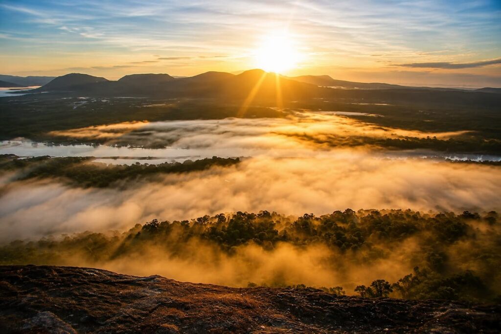
Before dawn, Pha Chana Dai can be almost entirely dark, with little indication of the landscape waiting beyond the cliff. Gradually the horizon begins to brighten above Laos before the sun appears and reveals the forests, mountain ridges and Mekong landscape below.
During favourable conditions, mist can settle through the lower landscape, adding another layer to the sunrise. The end of the rainy season and beginning of the cooler months also bring seasonal wildflowers to the Dong Na Tham forest, making the wider area particularly rewarding to explore.
But mist isn’t essential to the experience. What makes Pha Chana Dai distinctive is where you are when the sun appears — standing on a sandstone cliff at Thailand’s eastern frontier, watching the country begin another day.
What You’ll See
The viewpoint opens across a landscape shared visually by Thailand and Laos, with forested terrain, distant mountain ridges and the Mekong border region stretching below.
The surrounding Dong Na Tham landscape is also very different from the northern mountain scenery of Phu Chi Fa. Sandstone terraces, dry dipterocarp forest, pine, seasonal flowers, waterfalls and exposed cliffs characterise this part of Pha Taem National Park.
That difference is exactly why Pha Chana Dai deserves its own place in this guide. Phu Chi Fa is about standing above the northern mountains and mist; Pha Chana Dai is about experiencing sunrise on Thailand’s eastern frontier.
Getting There and What to Expect
Pha Chana Dai requires more planning than many of Thailand’s roadside viewpoints.
Access is through the Dong Na Tham section of Pha Taem National Park, around two hours by road from Ubon Ratchathani city. Historically, the final route was sufficiently rough that four-wheel-drive vehicles were recommended. More recent reports indicate that access has been substantially improved, although conditions on the final sections can still vary.
The park controls access to the viewpoint, with scheduled periods for vehicles travelling into and out of the area. Local transport may also be available for visitors who don’t want to tackle the approach in their own vehicle. Because arrangements can change with weather and seasonal conditions, check directly with Pha Taem National Park before making the journey, rather than relying on old access information online.
From the visitor area, the final approach to the viewpoint continues on foot, so bring a torch or headlamp if you’re heading out before sunrise.
Best Time to Experience Pha Chana Dai
Sunrise is unquestionably the defining experience, and the late-rainy to early-cool period is particularly interesting. From around October into December, seasonal wildflowers appear across parts of Dong Na Tham, while cooler conditions can also bring mist into the landscape.
An overnight stay can make the experience considerably easier. Camping is available within the Dong Na Tham area, allowing you to wake close to the viewpoint rather than beginning a long drive through Ubon Ratchathani in the middle of the night.
Pha Chana Dai also makes sense as part of a wider visit to Pha Taem National Park, where prehistoric rock paintings, unusual sandstone formations, waterfalls and viewpoints above the Mekong turn the journey into much more than a single sunrise stop.
For travellers prepared to make the effort, however, there is something wonderfully simple about the reason for coming here: to stand at Thailand’s eastern edge and be among the first in the country to see the sun rise.
Khao Takhian Ngo, Phetchabun — Wake Above a Sea of Mist
Some viewpoints are worth visiting for an hour. Khao Takhian Ngo offers the opportunity to make the viewpoint itself part of your overnight experience.
Located in the mountainous Khao Kho district of Phetchabun, Khao Takhian Ngo is known for its 360-degree panorama, sunrise and sea of mist. TAT specifically identifies it as one of Khao Kho’s standout mist viewpoints, with camping available around the hilltop.
Arriving before sunrise is beautiful. Spending the night there, waking in the cool mountain air and stepping outside your tent as the first light begins to reveal the landscape makes it something more.
What Makes the Experience Special
Khao Takhian Ngo’s appeal comes from the openness of the view. Instead of looking through a narrow gap between mountains, you can take in a broad 360-degree landscape across Khao Kho and the surrounding Phetchabun ranges. TAT even highlights the distinctive Khao Pu Khao Ya mountain formation visible from the viewpoint.
When conditions are right, morning mist settles through the valleys beneath the viewpoint, leaving hills and mountain peaks emerging above a blanket of white.
But the mist shouldn’t be treated as guaranteed. What you find in the morning depends on humidity, rainfall, temperature and wind. The wider Khao Kho area is particularly associated with mist after rainfall, and TAT continues to promote it as a green-season mist destination.
That uncertainty is part of the experience: you go to sleep knowing that the landscape outside your tent may look completely different when you wake.
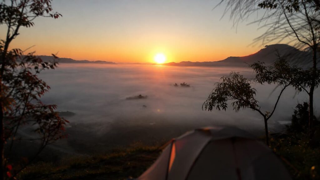
Camping at Khao Takhian Ngo
Camping is what separates Khao Takhian Ngo from many of the other viewpoints in this guide.
There is a designated area for tents at the viewpoint, allowing visitors to stay through the evening, sleep beneath the night sky and already be in position when dawn arrives. TAT specifically promotes overnight camping here as part of the experience.
You don’t have to camp. Staying elsewhere around Khao Kho and driving to the viewpoint before sunrise is an easier option if sleeping in a tent isn’t part of your idea of a holiday.
But for travellers who enjoy camping, there is something appealing about removing the journey altogether. Instead of setting an alarm and driving through darkness to find a viewpoint, you wake up at the viewpoint itself.
Sunrise and the Sea of Mist
Sunrise is the defining time to experience Khao Takhian Ngo.
Before dawn, the surrounding mountains can be little more than silhouettes. As the light increases, the valleys gradually become visible and, on good mornings, layers of mist spread across the landscape below.
The experience changes quickly. Mist can move, lift or disappear as the morning warms, so being there before sunrise gives you the best opportunity to watch the landscape develop rather than arriving after the most atmospheric conditions have already passed.
Khao Kho is famous for this combination of mountains, cool air and mist, and Khao Takhian Ngo provides one of the area’s broadest perspectives.
Getting to Khao Takhian Ngo
Khao Takhian Ngo is in Khao Kho district, around 25 kilometres along Highway 2258 from the main Khao Kho area according to TAT’s published directions. The final approach to the viewpoint is paved, and TAT states that ordinary vehicles can reach the site.
That relatively straightforward access makes the experience surprisingly flexible. You can incorporate it into a wider Khao Kho trip, arrive before sunrise from nearby accommodation or spend the night at the viewpoint.
Khao Kho itself deserves more than a hurried visit. Mountain scenery, Wat Phra That Pha Son Kaew, scenic cafés, national parks and other viewpoints make this one of central-northern Thailand’s most rewarding highland areas.
But Khao Takhian Ngo gives you a particularly memorable way to experience it: go to sleep in the mountains, then wake to discover whether the valleys below have disappeared beneath a sea of mist.
Khao Daeng, Prachuap Khiri Khan — Climb Above Wetlands and Limestone Peaks
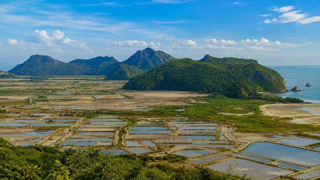
Khao Daeng reveals a side of coastal Thailand that can easily be missed if you think only in terms of beaches and islands. From this relatively modest limestone peak in Khao Sam Roi Yot National Park, the landscape opens across jagged mountains, waterways, villages, wetlands and the Gulf of Thailand.
The provincial tourism authority recommends the early morning, particularly around 5:30–7:00 am, when sunrise appears from the direction of the sea and the surrounding landscape is illuminated by the first light.
What makes Khao Daeng special isn’t one enormous landmark. It is being high enough to suddenly understand how all the different pieces of Sam Roi Yot fit together.
A Different Side of Coastal Thailand
Khao Sam Roi Yot means roughly “Mountain of Three Hundred Peaks,” an appropriate name for the extraordinary limestone landscape surrounding the viewpoint. Thailand’s Department of Mineral Resources describes the area as a karst landscape of eroded limestone, while wetlands cover a substantial part of the national park.
From Khao Daeng, that geography becomes much easier to appreciate.
Look in one direction and limestone peaks rise abruptly from the lowlands. Elsewhere you can pick out Sam Phraya Beach, Khao Daeng Canal, villages and traditional fishing communities, with the Gulf of Thailand beyond.
It creates a panorama quite unlike the island-filled Andaman views elsewhere in this guide. This is a landscape where mountains, water and everyday life sit alongside one another.
The Climb to Khao Daeng
Don’t let the relatively short distance fool you into assuming this is an effortless viewpoint.
The route climbs steeply over rocky limestone terrain. Published descriptions of the trail vary slightly depending on the starting point, but official provincial information describes a walk of approximately 725 metres from the parking area at the foot of Khao Daeng, while TAT material estimates around an hour for the climb.
Good footwear is worthwhile, particularly because limestone can become slippery when wet. Carry water and allow yourself enough time to climb without rushing.
The reward is a broad panorama that feels considerably more substantial than the relatively short trail might suggest.
When to Go
Early morning is the experience to aim for.
Apart from the sunrise, starting early helps you avoid climbing exposed rocky terrain during the hotter part of the day. The official recommendation of approximately 5:30–7:00 am reflects both the sunrise and the quality of the morning landscape.
Weather matters here. Wet rock can make the climb considerably less comfortable, and national-park access can change because of seasonal or safety conditions. Check current conditions with the park before travelling rather than assuming the trail will always be open.
Combine It With Khao Sam Roi Yot National Park
Khao Daeng makes much more sense as part of a day — or several days — exploring Khao Sam Roi Yot National Park than as an isolated viewpoint stop.
Thailand’s first marine national park covers around 98 square kilometres and protects an unusual combination of limestone mountains, wetlands, canals, coastline and wildlife habitat.
Nearby Khao Daeng Canal offers a completely different perspective from water level, while elsewhere in the park you can explore beaches, wetlands and the famous Phraya Nakhon Cave.
That combination is one of the reasons we rate Khao Daeng so highly. You can begin the morning standing above the landscape watching the sun rise from the Gulf, then spend the rest of the day exploring the very mountains, waterways and wetlands you were looking across.
Khao Daeng isn’t simply a beautiful view over Sam Roi Yot — it is one of the best places to understand what makes this unusual national park so special.
Khao Ngon Nak (Dragon Crest), Krabi — Earn the View
Some of Thailand’s most spectacular viewpoints can be reached almost effortlessly. Khao Ngon Nak asks considerably more of you.
Also widely known as Dragon Crest Mountain, Khao Ngon Nak rises behind the coastline north of Ao Nang in Krabi. The trail climbs through tropical forest towards a series of elevated viewpoints where the landscape opens across forested hills, limestone formations, coastline and islands scattered through the Andaman Sea.
Khao Ngon Nak reaches around 500 metres above sea level and lies within the protected landscape associated with Hat Noppharat Thara–Mu Ko Phi Phi National Park. The mountain supports lowland evergreen forest even close to its higher elevations.
But the reason Khao Ngon Nak belongs in this guide isn’t simply what you see from the top. The hike is part of the viewpoint experience.
Why the Hike Is Part of the Experience
There is no vehicle carrying you to a viewing platform and no quick roadside stop.
Instead, the landscape has to be approached gradually on foot. The trail begins beneath dense tropical vegetation before climbing steadily through the forest. As you gain elevation, occasional openings begin to reveal how far you have climbed and hint at the much broader landscape ahead.
That progression matters.
By the time the forest finally gives way to the major viewpoints, the panorama feels like a reward rather than something you simply arrived to photograph.
It also gives Khao Ngon Nak a completely different character from nearby Samet Nangshe. Both reveal extraordinary southern Thai landscapes, but they shouldn’t be considered competing versions of the same experience. Samet Nangshe is about being in position as sunrise transforms Phang Nga Bay; Khao Ngon Nak is about earning an elevated Andaman panorama on foot.
What You’ll See From the Viewpoints
From the higher sections of Khao Ngon Nak, the scale of Krabi’s landscape becomes much clearer.
Dense green forest stretches below the mountain while limestone formations rise abruptly from the surrounding terrain. Beyond them lies the Andaman coastline, with bays and islands extending towards the horizon.
It is a particularly good place to appreciate that Krabi is much more than its famous beaches. From above, you begin to see the relationship between the province’s mountains, karst formations, forest, coastline and offshore islands.
Different points along the trail reveal different parts of that landscape, so don’t treat the hike purely as a race to reach the highest possible position. Some of the most rewarding views appear before the final section.
Trail Difficulty and What to Expect
Khao Ngon Nak should be approached as a genuine hike rather than a casual walk to a viewpoint.
The route includes sustained uphill sections, uneven ground, exposed roots and rocky terrain. Heat and humidity can make the climb considerably more demanding than the elevation alone suggests, particularly if you aren’t accustomed to hiking in tropical conditions.
Allow several hours for the complete experience rather than trying to squeeze it between other activities. Your pace, trail conditions and the amount of time you spend at the viewpoints will all affect how long the outing takes.
Good footwear makes a significant difference. This isn’t a trail where sandals or smooth-soled casual shoes are a particularly good idea, especially after rain.
Because the route lies within a protected natural area, access conditions and seasonal arrangements can change. Thailand’s national parks operate annual and weather-related closures at various locations, so check current park information before travelling rather than relying on an old trail report. TAT publishes the Department of National Parks’ current annual closure schedule for this reason.
Best Time to Hike
Starting early is usually the sensible choice.
Morning temperatures are generally more comfortable, you reduce the amount of climbing undertaken during the strongest heat of the day, and an early departure gives you more time to enjoy the viewpoints without worrying about completing the descent late.
Weather deserves particular attention. Heavy rain can make roots and rocks slippery, while low cloud can obscure the very panorama you have climbed to see.
That doesn’t mean you need perfect blue skies. Broken cloud moving through the limestone landscape can create some of the most atmospheric conditions of all. The important distinction is between dramatic weather and conditions that make the trail unsafe.
What to Bring
Carry more drinking water than you think you’ll need, particularly on hot or humid days. Sun protection is useful once you reach exposed areas, while insect repellent can make the forest sections more comfortable.
A sensible minimum includes:
- Drinking water
- Supportive footwear with good grip
- Sun protection
- Insect repellent
- A charged phone
- Light rain protection when conditions are uncertain
And don’t underestimate the descent. Reaching the viewpoint may feel like the achievement, but you still have to return down the same mountain.
Khao Ngon Nak is therefore one of the more demanding viewpoints in this guide — but that is precisely why it belongs here. The panorama isn’t simply something you see. The climb through the forest, the first glimpses through the trees and finally stepping out above Krabi’s extraordinary landscape are all part of earning the view.
Samet Nangshe, Phang Nga — Watch Phang Nga Bay Wake Up
Few viewpoints reveal southern Thailand quite as dramatically as Samet Nangshe.
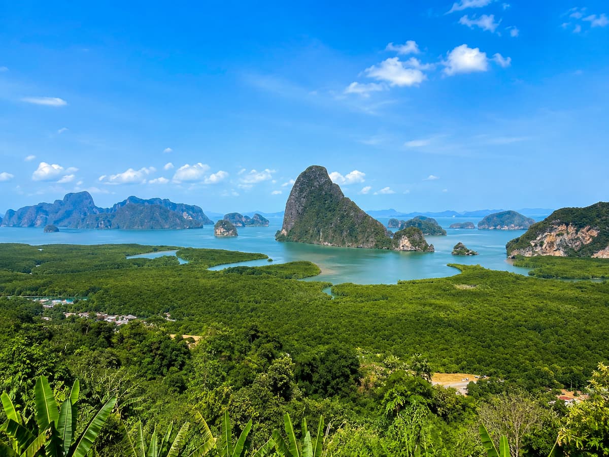
From the hills of Takua Thung in Phang Nga, the landscape falls away towards mangrove forest and the sheltered waters of Phang Nga Bay, where dozens of limestone islands and karst formations rise almost vertically from the water. The view faces east, making sunrise the defining experience. TAT describes Samet Nangshe as one of Phang Nga’s outstanding viewpoints and specifically highlights the first light appearing across the islands of the bay.
Arrive in darkness and much of that landscape is initially hidden. Then the horizon begins to brighten, the silhouettes of the limestone islands become clearer and eventually one of Thailand’s most distinctive coastal landscapes spreads out beneath you.
What Makes Samet Nangshe Extraordinary
Phang Nga Bay is beautiful from water level, but elevation completely changes your understanding of it.
From Samet Nangshe you can see how the limestone islands are distributed across the bay, surrounded by water and extensive mangrove forest. Rather than focusing on one famous formation, you are looking across the wider geography that makes Ao Phang Nga so unusual.
TAT describes Phang Nga Bay as a geological landscape filled with islands, caves and dramatic rock formations rising vertically from the sea.
From above, those features become one enormous panorama.
That is also what separates Samet Nangshe from Khao Ngon Nak. At Dragon Crest, the hike is fundamental to the experience. At Samet Nangshe, the transformation of Phang Nga Bay by changing light is the experience.
Sunrise at Samet Nangshe
If your schedule allows only one visit, make it sunrise.
You’ll need an early start, but arriving before the sun appears lets you experience the landscape gradually rather than simply arriving to find it already illuminated.
On clear mornings, first light catches the water and limestone formations as the sky changes colour behind them. During wetter periods the experience can be completely different. TAT currently highlights Samet Nangshe as one of Thailand’s green-season sea-of-mist locations, when thin layers of mist can drift between the limestone islands after rainfall.
Neither perfect visibility nor mist can be guaranteed, and that is worth remembering when planning a visit. Cloud, humidity and recent rainfall can transform the view from one morning to the next.
Sunset can also be beautiful, but because the viewpoint looks across the bay towards the east, sunrise is the experience that really defines Samet Nangshe.
Getting to the Viewpoint
Samet Nangshe is on the Phang Nga mainland in Takua Thung district, north of Phuket.
For travellers staying in Phuket, this makes it entirely achievable as a day trip, although sunrise requires a very early departure. TAT places the viewpoint around 25 kilometres by road from the bridge connecting Phuket with the mainland; from Patong, the journey is considerably longer.
Allow more time than the distance alone suggests. Part of the pleasure of visiting this part of Phang Nga is leaving the heavily developed resort areas behind and travelling through a much quieter landscape of villages, plantations, forest and limestone hills.
Access arrangements around the upper viewpoints can change, so check current local information before setting out, particularly if you’re planning to arrive before daylight.
Stay Overnight or Visit From Phuket?
If sunrise is important to you, staying nearby has a major advantage.
Accommodation and camping options around the Samet Nangshe area allow you to position yourself close to the viewpoint the night before rather than beginning the experience with a long drive in darkness. TAT has also previously highlighted camping at the viewpoint, where the lack of major urban light pollution can make the night sky another attraction.
Staying locally also gives you the opportunity to explore more of Phang Nga rather than treating the viewpoint as a quick excursion from Phuket.
If you’re already based in Phuket, however, Samet Nangshe is still very achievable. Just accept that experiencing it properly means sacrificing a comfortable morning in bed.
And this is one occasion when the alarm is worth it.
Watching first light gradually reveal the limestone islands of Phang Nga Bay is not simply one of southern Thailand’s great views — it is one of those occasions when being there at the right moment changes the entire experience.
John-Suwan Viewpoint, Koh Tao — Look Across a Tropical Island
John-Suwan Viewpoint offers something none of the mountain viewpoints in this guide can quite replicate: the opportunity to climb above a relatively small tropical island and see its geography laid out beneath you.
Located at the southern end of Koh Tao in Surat Thani Province, the viewpoint looks back across the island from a rocky outcrop above the coast. On one side lies Chalok Baan Kao Bay; on the other, Thian Og — better known as Shark Bay — while a narrow spine of densely vegetated land stretches between them towards the interior of Koh Tao. The Koh Tao Tourism Association lists John-Suwan among the island’s three most popular viewpoints.
It is one of those views that helps you understand the place you’re visiting. From beach level, Koh Tao is a collection of bays, beaches and forested hills. From John-Suwan, you can suddenly see how they fit together.
What You’ll See
The distinctive feature of John-Suwan is the two-bay panorama.
Looking north across Koh Tao, Chalok Baan Kao curves around the western side while Shark Bay occupies the eastern coastline. Between them, tropical vegetation covers the narrow peninsula before rising into the island’s hilly interior.
The surrounding water changes colour with depth and light, while the contrast between green forest, pale beaches and the Gulf of Thailand creates one of Koh Tao’s most recognisable panoramas.
Unlike Samet Nangshe, where you look outward across dozens of limestone islands, John-Suwan turns your attention back towards the island you’re standing on.
It feels less like looking at Koh Tao and more like seeing the shape of Koh Tao revealed beneath you.
The Climb to John-Suwan Viewpoint
The good news is that you don’t need a Dragon Crest-sized expedition to experience it.
The Koh Tao Tourism Association describes the climb from the southern end of Chalok as approximately a 10–15 minute scramble, although allowing 15–20 minutes is sensible depending on your pace. The route is short but steep, climbing through tropical vegetation and across rocky ground before reaching the viewpoint.
There are rough sections where you need to negotiate rocks, and ropes are available to assist on parts of the climb. Closed shoes with reasonable grip are a much better choice than flip-flops.
The combination of tropical heat and steep terrain can also make such a short climb surprisingly sweaty. Take water and don’t judge the effort purely by the distance.
Best Time to Visit
Early morning is an excellent time to make the climb.
Temperatures are cooler, the trail is generally more comfortable and the eastern side of the viewpoint gives you the opportunity to see first light over Shark Bay. The viewpoint’s position between eastern and western coastlines means both sunrise and late-day light can work, although conditions and cloud will ultimately determine the experience.
Avoiding the strongest midday heat is worthwhile regardless of photography. The exposed rocks at the top offer little relief from the tropical sun.
Rain deserves particular caution. The rocky approach can become slippery when wet, making the descent especially awkward.
Getting There
The trail begins near Freedom Beach at the southern end of Koh Tao, reached through the Chalok Baan Kao area.
Access fees apply at some Koh Tao viewpoints, including this area, and these can change. The Koh Tao Tourism Association recommends carrying cash when exploring the island’s viewpoints rather than assuming access will be free.
Koh Tao itself has no airport or bridge connection, so reaching the island requires travelling by ferry. Once there, John-Suwan is straightforward to incorporate into time spent exploring the southern part of the island.
Combine the Viewpoint With Southern Koh Tao
This is one viewpoint where you definitely don’t need to turn around and immediately head somewhere else.
Freedom Beach lies below the trail, while Chalok Baan Kao and other beaches around southern Koh Tao provide opportunities for swimming, snorkelling and relaxing after the climb. The local tourism association specifically recommends combining the island’s shorter viewpoint hikes with its beaches and coastline.
That combination makes John-Suwan particularly satisfying. You can climb through tropical vegetation in the morning, stand above two beautiful bays and then descend to spend the rest of the day beside the same water you were looking across from above.
For a relatively short climb, John-Suwan delivers something remarkably rewarding: the chance to stand above Koh Tao and see an entire tropical island landscape unfold beneath you.
Karon Viewpoint, Phuket — A Spectacular View Without the Hike
Not every memorable viewpoint in Thailand needs to involve a mountain trail, an alarm before dawn or several hours of climbing.
Karon Viewpoint is proof that sometimes you can simply stop the car, walk a few steps and find an extraordinary landscape waiting in front of you.
Located beside the coastal road between Kata Noi and Nai Harn in southern Phuket, the viewpoint looks north across three of the island’s west-coast beaches: Kata Noi, Kata and Karon. Their crescent-shaped bays appear one beyond another, separated by green headlands with the Andaman Sea stretching away to the west. Phuket’s provincial government describes it as the Three Bay Viewpoint, while TAT includes it as a key stop on its recommended Phuket sightseeing route.
After several more demanding viewpoints in this guide, that accessibility is precisely why Karon deserves its place.
The Three-Beach Panorama
The viewpoint’s Thai name is associated with the three bays visible from the hillside, and once you’re standing there the reason is obvious.
Kata Noi is the closest, tucked beneath the hillside. Beyond it lies the broader curve of Kata Beach, with small Koh Pu sitting offshore, while the much longer sweep of Karon Beach extends northwards in the distance. The three bays form a sequence of crescents along Phuket’s western coastline.
It is a particularly useful perspective if you’ve already spent time exploring these beaches individually. From ground level they feel like separate destinations; from Karon Viewpoint, you can see how closely they are connected along the same mountainous coastline.
The changing shades of the Andaman Sea, pale beaches and densely vegetated headlands also make this one of Phuket’s classic coastal photographs.
Why Accessibility Is Part of the Appeal
Karon Viewpoint is almost the opposite of Khao Ngon Nak.
There is no substantial hike to complete and no particular level of fitness required to enjoy the main panorama. The viewpoint sits directly beside Route 4233, with parking close to the viewing area.
That doesn’t make the experience less worthwhile.
One of the pleasures of travelling around Thailand is occasionally discovering that an exceptional landscape requires almost no effort at all. Karon Viewpoint can be a ten-minute stop during a day exploring southern Phuket, or somewhere you linger while watching the light change across the coastline.
It also makes this one of the most accessible viewpoints in our selection for travellers who don’t want — or aren’t able — to undertake a demanding climb.
Best Time to Stop
Visibility is more important here than chasing one particular moment.
Clear conditions reveal all three beaches and the coastline stretching north, while softer morning or late-afternoon light can make the layers of headlands particularly attractive.
Late afternoon works naturally if you’re travelling south along Phuket’s west coast, although Karon Viewpoint isn’t somewhere you need to build an entire day around a precise sunrise or sunset.
If the weather is clear when you’re passing, stop. Phuket’s tropical conditions can change quickly, and there is little advantage in driving past a beautiful panorama today because a forecast suggests tomorrow might be marginally better.
Make It Part of a Southern Phuket Drive
This is probably the best way to experience Karon Viewpoint.
Rather than travelling across Phuket solely to stand at the viewpoint for a few minutes, incorporate it into a journey through the southern part of the island. TAT itself places Karon Viewpoint on a Phuket sightseeing route that continues towards Promthep Cape, while the official Thai tourism information also notes that continuing south from Karon Viewpoint leads towards the cape.
Kata and Kata Noi are immediately below, while continuing south brings you towards Nai Harn, Ya Nui and the viewpoints and coastline around Phuket’s southern tip.
That gives Karon Viewpoint a different role from somewhere like Samet Nangshe. You don’t necessarily make the journey for the viewpoint — you make the viewpoint part of the journey.
And sometimes that’s exactly what a great viewpoint should be: an easy place to stop, look back along the road you’ve been travelling and suddenly see an entire section of Thailand’s coastline laid out in front of you.
Aiyerweng Skywalk, Yala — Walk Above the Rainforest
Far into Thailand’s deep south, Aiyerweng Skywalk offers one of the most unusual viewpoint experiences in the country: walking onto a glass platform above layers of forested mountains and a vast sea of morning mist.
Located in Aiyerweng subdistrict in Betong, Yala Province, the viewpoint stands more than 2,000 feet above sea level. Its elevated glass walkway extends for 61 metres, providing panoramic views across the mountainous landscape surrounding Betong. (thailand.go.th)
This is a very different southern Thailand from the beaches and islands most international visitors know. There is no Andaman Sea on the horizon and no line of resorts below. Instead, Aiyerweng looks across dense tropical forest, mountains and mist close to Thailand’s border with Malaysia.
The Aiyerweng Sea of Mist
The sea of mist is the reason Aiyerweng became famous.
Moist air gathers through the valleys beneath the surrounding mountains, creating layers of white cloud below the viewpoint. Unlike many northern mist destinations that are most strongly associated with Thailand’s cool season, official tourism information promotes Aiyerweng as a place where mist can occur throughout the year. (thailand.go.th)
Early morning provides the defining experience.
Before sunrise, mountains can appear as dark silhouettes above the mist. As daylight increases, layers of forest gradually emerge while cloud remains trapped in the valleys below.
TAT recommends arriving around 6:00 am on its Betong itinerary, specifically to experience the 360-degree sea of mist from the skywalk. (thai.tourismthailand.org)
As with every mist viewpoint, conditions are never completely predictable. But here the combination of tropical humidity, forest and mountainous terrain gives visitors a genuine opportunity to experience a phenomenon more commonly associated with northern Thailand.
Walking Onto the Glass Skywalk
The structure itself makes Aiyerweng fundamentally different from the other viewpoints in this guide.
Rather than simply standing at the edge of a mountain, visitors ascend a six-level viewing structure before walking along an elevated walkway towards a circular glass observation platform. (thai.tourismthailand.org)
Look outward and the experience is beautiful.
Look down through the transparent floor and it becomes something else entirely.
The 61-metre glass walkway projects you visually into the landscape, creating the sensation of standing above the mist and forest rather than simply observing it from a hillside. Official Thai government tourism information describes it as providing unobstructed views in every direction. (thailand.go.th)
For anyone uncomfortable with heights, the glass floor may be considerably more memorable than the sunrise.
Best Conditions and Time to Visit
Go early.
The viewpoint is designed around the morning experience, and historical official information lists operating hours beginning at 5:30 am. Opening times, entrance fees and local access arrangements can change, however, so check current information before travelling rather than planning around an old timetable. (thailand.go.th)
Arriving before or around sunrise gives you the best opportunity to watch the light develop across the mist and mountains.
Recent rainfall and humidity can contribute to atmospheric conditions, although heavy rain or very low cloud can obviously reduce visibility. As elsewhere in this guide, a sea of mist should be treated as something nature provides rather than something a ticket guarantees.
Getting There From Betong
Aiyerweng works best as part of a stay in Betong, rather than somewhere to rush towards from another major Thai destination for the morning.
Betong itself sits in mountainous southern Yala close to the Malaysian border. The journey into the region is part of what makes this selection interesting: the scenery, food and cultural character feel noticeably different from Thailand’s better-known southern resort areas. Official Thai tourism itineraries pair Aiyerweng with Betong and the wider Yala region rather than treating the skywalk as an isolated attraction. (thai.tourismthailand.org)
For the viewpoint itself, road access brings visitors close to the site, making Aiyerweng considerably easier physically than hiking viewpoints such as Khao Ngon Nak or Khao Daeng.
The early start is likely to be the greater challenge.
Planning Travel in Yala
Yala deserves one additional consideration that isn’t necessary for most destinations in this guide.
Parts of Thailand’s southern border provinces have experienced longstanding security issues. TAT currently advises visitors to exercise special caution and remain vigilant about personal security when travelling in Yala and notes that security measures can occasionally be introduced in affected areas. (tourismthailand.org)
That doesn’t mean presenting Betong as somewhere travellers should automatically avoid. It means treating the journey sensibly.
Check your government’s current travel advice, review local conditions before departure and follow any guidance from Thai authorities while travelling in the region.
For travellers who do make the journey, Aiyerweng provides something our other southern viewpoints cannot: a chance to leave Thailand’s famous coastline behind and step out above the mist, mountains and tropical forests of the deep south.
Hin Sam Wan, Bueng Kan — Stand on Three Whale Rock
Some viewpoints are memorable because of what lies in the distance. At Hin Sam Wan, the ground beneath your feet is every bit as remarkable as the panorama ahead.
Hidden among the forests of Phu Sing in Bueng Kan, northeastern Thailand, three enormous sandstone formations extend towards the edge of the mountain. Seen from above, their long rounded shapes resemble a family of whales swimming together through an ocean of green — giving them their English name, Three Whale Rock.
Thailand’s Royal Forest Department dates the sandstone formations to approximately 75 million years old, while the Department of Tourism identifies Hin Sam Wan as one of the distinctive natural landmarks within the wider Phu Sing landscape. (forest.go.th) (tfo.dot.go.th)
The viewpoint experience is unusual because you don’t simply stand somewhere looking at Three Whale Rock. You can walk out onto the enormous sandstone formations themselves.
Why It’s Called Three Whale Rock
Hin Sam Wan consists of three separate sandstone masses positioned alongside one another near the edge of Phu Sing.
Their resemblance to whales is clearest when viewed from the air or from the correct angle at a distance. The largest is commonly referred to as the father whale, alongside the smaller mother and baby formations. TAT describes them as appearing like a family of three whales swimming together. (tourismthailand.org)
They form part of a much larger sandstone landscape. Phu Sing contains cliffs, caves, rock terraces and naturally weathered formations spread throughout the forest, created through long-term geological processes. (tourismthailand.org)
But Hin Sam Wan is unquestionably the formation that captures your attention.
Walking onto one of the huge slabs, with forest dropping away around it, creates an experience that feels considerably more adventurous than standing behind the railing of a conventional viewpoint.
The View Towards the Mekong and Laos
Look east from Hin Sam Wan and the landscape stretches across Phu Wua forest, waterways and the sandbanks of the Mekong, with the mountains around Pak Kading in Laos visible beyond the river on clear days. Bueng Kan’s municipal tourism information specifically identifies these features in the panorama from the eastern side of Phu Sing. (buengkhanml.go.th)
This gives Hin Sam Wan a distinctly northeastern Thai character.
There are no tropical islands below and no densely developed city on the horizon. Instead, the view is dominated by forest and the vast border landscape surrounding the Mekong.
It is another reminder of just how dramatically Thailand changes as you travel around the country.
Sunrise at Hin Sam Wan
Early morning is the experience to aim for.
The formations face towards the eastern landscape, and local authorities identify Hin Sam Wan as a sunrise viewpoint. TAT also recommends arriving early, when cooler conditions and occasional morning mist can make the surrounding forest particularly atmospheric. (buengkhanml.go.th) (tourismthailand.org)
As the sun rises towards Laos, light gradually spreads across the sandstone and the enormous expanse of forest below.
Unlike Pha Chana Dai, however, the sunrise isn’t the only reason for coming. At Hin Sam Wan, the rock formation itself remains part of the experience throughout the day.
Getting There and Exploring Phu Sing
Hin Sam Wan lies within the protected forest landscape of Phu Sing, rather than beside a conventional public road.
The Department of Tourism describes walking trails through the forest to the rocks, while TAT has historically advised using suitable high-clearance or four-wheel-drive transport for the mountain approach, with local pickup transport available from the Phu Sing visitor area. (tfo.dot.go.th) (tourismthailand.org)
Because road conditions, transport arrangements and opening hours can change, check current information at the visitor centre before travelling rather than relying on historical prices or schedules.
The wider Phu Sing area is worth exploring rather than rushing directly to Three Whale Rock and leaving. Other natural formations, caves and viewpoints are scattered throughout the sandstone mountain and forest landscape. TAT notes that sunrise and sunset can both be experienced from Phu Sing, while the Royal Forest Department identifies several additional scenic points overlooking the surrounding forests and towards the Mekong. (tourismthailand.org) (forest.go.th)
There is one final consideration here: take the exposed rock seriously. The formations sit beside substantial drops, and official authorities have specifically reminded visitors to exercise caution around the viewpoint. (mots.go.th)
There is no photograph worth stepping somewhere unsafe to capture.
For travellers willing to venture into Thailand’s far northeast, Hin Sam Wan provides a fitting final experience for our main selection: walk onto an ancient sandstone formation above a vast green landscape, then watch the sun rise towards the Mekong and the mountains of Laos.
Three More Viewpoints Worth Experiencing
Choosing only 10 scenic viewpoints inevitably leaves some remarkable places behind. The following three didn’t make our main selection, but each offers an experience different enough to deserve consideration if your travels take you nearby.
Pai Canyon, Mae Hong Son — Walk the Ridges at Sunset
Pai Canyon isn’t a conventional mountain viewpoint. Wind and rain have eroded the landscape into narrow red sandstone ridges, gullies and steep-sided pathways overlooking the mountains and valleys surrounding Pai.
The main viewpoint requires only a short walk through the forest, but those wanting to explore farther can follow the exposed ridges deeper into the canyon. Some sections have substantial drops and narrow paths, so you don’t need to tackle the more adventurous sections to appreciate the landscape. TAT describes drops reaching around 50 metres and recommends proper footwear for exploring beyond the main viewing area.
Sunset is the experience that makes Pai Canyon particularly memorable. As the sun drops behind the mountains west of Pai, the warm light catches the eroded ridges while the surrounding valley gradually falls into shadow. TAT identifies it as Mae Hong Son’s most popular sunset viewpoint.
If you’re already staying in Pai, this is an easy addition to the trip — and one where the unusual landscape beneath your feet is almost as interesting as the view beyond it.
Noen Nang Phaya, Chanthaburi — Look Down on Thailand’s Scenic Coastal Road
At Noen Nang Phaya, part of the attraction is seeing the journey itself.
The viewpoint sits above the Chaloem Burapha Chonlathit coastal road in Chanthaburi’s Na Yai Am district, close to Kung Wiman Bay. From the hillside you can look down across the road as it curves around the green coastline with the Gulf of Thailand stretching alongside it. Thailand’s official Tourism Directory highlights both the coastal road and sea views as defining features of the viewpoint.
Rather than treating Noen Nang Phaya as an isolated attraction, incorporate it into a drive along Chanthaburi’s coast. Beaches, bays and coastal scenery accompany much of the route, before the elevated viewpoint gives you the opportunity to look back across part of the landscape you’ve just travelled through.
It’s another example of why a great viewpoint doesn’t necessarily need to involve a difficult climb.
Sometimes the road to the viewpoint is part of what makes the view worth seeing.
Phu Thok, Loei — Wake to Mist Above Chiang Khan
If you’re spending time in Chiang Khan, Phu Thok offers a very different way to experience the surrounding landscape.
The small mountain rises outside town and is best known for its early-morning views, when mist can settle across the lowlands and hills around the Mekong region. It makes a natural contrast to an evening spent walking Chiang Khan’s historic riverside streets: go to bed beside the Mekong, then get up early and see the wider landscape from above.
Phu Thok doesn’t need to compete with Phu Chi Fa or Khao Takhian Ngo for the title of Thailand’s greatest sea-of-mist viewpoint. Its appeal is more closely connected to the journey through Chiang Khan and Loei.
That makes it exactly the sort of viewpoint worth remembering when planning a route through northeastern Thailand: perhaps not somewhere to cross the entire country solely to visit, but a beautiful experience that can make an already worthwhile destination even better.
Choosing the Right Thailand Viewpoint for Your Trip
You don’t need to experience every viewpoint in this guide to appreciate Thailand from above. In many cases, the best choice is simply the one that fits naturally into the journey you’re already planning.
If you’re travelling through northern Thailand, waking before dawn for Phu Chi Fa may become one of the defining experiences of the trip. If you’re staying in Phuket, Karon Viewpoint requires almost no planning, while Samet Nangshe rewards a much earlier start and a journey onto the Phang Nga mainland. And if hiking is part of the attraction rather than an inconvenience, Khao Ngon Nak provides something completely different again.
The important question isn’t necessarily “Which viewpoint has the best view?” It is “Which viewpoint experience would I most enjoy?”
| If You Want To… | Consider | Why |
|---|---|---|
| Watch an unforgettable sunrise | Samet Nangshe | First light reveals the limestone islands of Phang Nga Bay |
| Stand above the clouds | Phu Chi Fa | Classic northern mountain and sea-of-mist experience |
| Experience Thailand’s first light | Pha Chana Dai | Sunrise from the country’s far eastern frontier |
| Camp at a viewpoint | Khao Takhian Ngo | Wake to a 360° mountain panorama and possible sea of mist |
| Earn the view on foot | Khao Ngon Nak | A substantial forest hike ending above Krabi’s Andaman landscape |
| Explore a national park | Khao Daeng | Combine the climb with the wetlands, karsts and coastline of Sam Roi Yot |
| See a tropical island from above | John-Suwan | Look across Koh Tao’s bays and forested interior |
| Find an incredible view without hiking | Karon Viewpoint | An easily accessible panorama across three Phuket beaches |
| Try something completely different | Aiyerweng | Walk onto a glass skywalk above rainforest and morning mist |
| Venture into Thailand’s northeast | Hin Sam Wan | Stand on ancient sandstone above forest and the wider Mekong landscape |
There is also no reason to restrict yourself to the main ten. Pai Canyon makes particular sense if you’re already exploring Mae Hong Son, Noen Nang Phaya can become part of a road trip along Chanthaburi’s coast, and Phu Thok adds an atmospheric early-morning experience to time spent in Chiang Khan.
The biggest difference may simply be how much effort you want the viewpoint to demand.
For an easy scenic stop, Karon is difficult to beat. For a short climb with a substantial reward, John-Suwan is a good middle ground. For travellers who actively want the hike to be part of the experience, Khao Ngon Nak is the obvious choice.
And if you’re prepared to organise an entire morning around a single moment, places such as Phu Chi Fa, Pha Chana Dai and Samet Nangshe demonstrate why sometimes the best viewpoint experiences begin long before the sun comes up.
When Is the Best Time to Visit Thailand’s Viewpoints?
There is no single best month for every viewpoint in Thailand. The country stretches across different climate zones, elevations and coastlines, so conditions that are perfect for a mountain sunrise in Chiang Rai may have little relevance to an island viewpoint in the Gulf of Thailand.
More importantly, the most scenic conditions aren’t always the clearest ones. Mist, broken cloud and the light immediately after rain can transform a viewpoint, while completely blue skies can sometimes produce a flatter landscape than expected.
For most viewpoints, choosing the right time of day and weather conditions matters as much as choosing the right season.
Northern and Northeastern Viewpoints
Thailand’s cooler months, broadly from November through February, are particularly popular for mountain viewpoints in Chiang Rai, Phetchabun, Loei and other northern and northeastern provinces.
Cooler early-morning temperatures make walking more comfortable, while atmospheric conditions can produce the seas of mist associated with places such as Phu Chi Fa and Khao Takhian Ngo.
However, mist is never guaranteed. It depends on humidity, overnight temperatures, wind and recent rainfall rather than simply appearing because you visit during a particular month.
One additional consideration later in the dry season is haze and regional air pollution, which can significantly reduce long-distance visibility across parts of northern Thailand. If panoramic mountain views are important to your trip, check current air-quality and visibility conditions before committing to a long journey.
Southern Viewpoints
Southern Thailand requires a little more planning because the Andaman and Gulf coasts don’t follow identical weather patterns.
For Andaman viewpoints in Phuket, Phang Nga and Krabi, the drier months generally provide a better chance of clear long-distance views, but the wetter green season shouldn’t automatically be dismissed. Samet Nangshe, for example, can become particularly atmospheric when mist forms among the limestone islands of Phang Nga Bay.
Koh Tao sits in the Gulf of Thailand and follows a different rainfall pattern from Phuket and Krabi, so don’t assume that weather on one coast tells you what is happening on the other.
In the deep south, Aiyerweng’s humid, mountainous environment can produce mist throughout the year, making conditions more important than choosing one narrow season.
Sunrise or Sunset?
For several viewpoints in this guide, the answer is straightforward.
Phu Chi Fa, Pha Chana Dai, Samet Nangshe, Khao Takhian Ngo and Hin Sam Wan are particularly rewarding around sunrise. At these locations, arriving before first light is part of the experience rather than simply a photography recommendation.
Pai Canyon and Noen Nang Phaya work particularly well towards sunset, when warmer light falls across their landscapes.
Other viewpoints are much more flexible. At Karon Viewpoint, for example, good visibility may matter more than arriving at one precise time.
Don’t Underestimate the Heat
For viewpoints requiring a substantial climb, an early start has another major advantage: temperature.
Thailand’s heat and humidity can make a hike considerably harder than the distance or elevation suggests. This is particularly relevant at Khao Ngon Nak and Khao Daeng, where exposed sections and sustained climbing can become uncomfortable during the hottest part of the day.
Carry enough water, use sun protection and allow more time than you might expect for an equivalent hike in a cooler climate.
Sometimes Imperfect Weather Creates the Best View
It is tempting to imagine every scenic viewpoint beneath a perfectly clear blue sky, but some of Thailand’s most memorable landscapes appear when the weather is doing something more interesting.
Mist can fill valleys beneath mountain peaks. Broken clouds can cast moving shadows across limestone formations. A passing shower can clear haze from the atmosphere, while early light breaking through clouds can create far more dramatic conditions than an entirely cloudless morning.
There is an important distinction, however, between atmospheric weather and unsafe weather.
Heavy rain can make limestone, exposed rock and forest trails slippery, while thunderstorms and strong winds are good reasons to reconsider exposed viewpoints altogether.
Check the forecast, follow local advice and be prepared to change your plans.
Thailand’s viewpoints aren’t controlled environments, and there is never a guarantee that the landscape will look exactly like the photograph that inspired your visit.
That unpredictability is part of experiencing them.
Viewpoint Safety and Responsible Travel
Thailand’s most scenic viewpoints range from roadside stops to exposed mountain trails, and the level of preparation they require varies just as widely. Karon Viewpoint may involve little more than stepping out of a vehicle, while Khao Ngon Nak, Khao Daeng and some of the more remote locations in this guide deserve to be treated as genuine outdoor activities.
For hiking viewpoints, wear footwear suited to the terrain, carry enough drinking water and allow plenty of time for the return journey. Tropical heat and humidity can make relatively short climbs surprisingly demanding, while rain can quickly turn exposed roots, sandstone and limestone into slippery surfaces.
Cliff edges deserve particular respect. Barriers, warning signs and closed areas are there for a reason, and stepping beyond them for a photograph is never worth the risk. The same applies to exposed formations such as Hin Sam Wan and the narrow ridges around Pai Canyon, where a moment of poor footing can have serious consequences.
Conditions can also change quickly in mountainous areas. If heavy rain, thunderstorms, strong winds or poor visibility make a trail uncomfortable or unsafe, turning around is the sensible decision. National parks and protected areas may temporarily close trails because of weather, maintenance or seasonal conservation requirements, so check current access information before travelling.
Responsible travel matters too. Stay on established trails where required, take rubbish with you, avoid damaging vegetation and rock formations, and follow local rules governing drones, camping and protected areas. Many of these viewpoints sit within national parks, forests or environmentally sensitive landscapes where seemingly small actions become significant when repeated by thousands of visitors.
Above all, experience the viewpoint rather than treating it simply as a backdrop for a photograph. You don’t need to stand on the most exposed rock, cross a barrier or recreate somebody else’s social-media image to come home with an extraordinary memory of the view.
Travel With Insight
My visit to Aiyerweng in Yala reinforced something I have increasingly found with viewpoints in Thailand: sometimes the experience around the viewpoint is just as important as the view itself.
I flew into Hat Yai and continued by minivan to Betong, arriving the day before visiting Aiyerweng. I would definitely recommend doing it this way rather than trying to rush the journey. The viewpoint is at its best early in the morning, when you have the chance of seeing the mist sitting across the forest below.
The glass skywalk itself extends for only around 60 metres, but that number doesn’t really describe the experience. It has been deliberately constructed out over the canopy to place you above the landscape, and standing there looking across the forest and morning mist makes the journey worthwhile — particularly if you are already interested in exploring this less-visited part of southern Thailand.
Betong’s location also adds something quite different to the trip. You are deep in Thailand’s far south, close to the Malaysian border, and you can travel out towards the Betong border checkpoint to experience that frontier setting and take some photographs around the permitted public areas. There is something genuinely interesting about travelling so far down the Thai peninsula that Malaysia is effectively the next stop.
Betong also gives you enough to turn the viewpoint into a relaxed overnight trip rather than simply travelling there, taking a photograph and leaving. After returning from Aiyerweng, I stopped for dim sum at Seng Dim Sum, spent some time relaxing, visited the hot spring and went to see Betong’s famous large mailbox. Later that evening, I headed back into town to photograph the clock tower at night before leaving the following morning.
It wasn’t a complicated itinerary, but that was part of what I enjoyed about it. Aiyerweng gave me the reason to make the journey, while Betong, the border location and the smaller experiences around town made the trip memorable.
That is how I would approach many of the viewpoints in this guide. Don’t necessarily travel somewhere simply to collect the view. Look at what surrounds it and let the viewpoint become part of experiencing the destination.
Frequently Asked Questions About Thailand Scenic Viewpoints
What is the most famous viewpoint in Thailand?
There isn’t one universally recognised as Thailand’s most famous viewpoint, but Samet Nangshe in Phang Nga and Phu Chi Fa in Chiang Rai are among the country’s most recognisable. Samet Nangshe is known for sunrise across the limestone islands of Phang Nga Bay, while Phu Chi Fa is famous for mountain scenery and its morning sea of mist.
What is the best viewpoint for sunrise in Thailand?
It depends on the experience you want. Samet Nangshe offers one of Thailand’s most dramatic coastal sunrises, while Phu Chi Fa combines sunrise with northern mountains and mist. Pha Chana Dai in Ubon Ratchathani is particularly interesting because its far-eastern location is associated with experiencing some of the earliest sunrise in Thailand.
Which scenic viewpoints in Thailand don’t require hiking?
Karon Viewpoint in Phuket is one of the easiest spectacular viewpoints to reach, with the viewing area located beside the coastal road. Aiyerweng Skywalk in Yala also provides an elevated experience without a substantial mountain hike, although reaching Betong and the viewpoint requires considerably more travel.
Where can I see a sea of mist in Thailand?
Sea-of-mist experiences are particularly associated with Thailand’s mountainous regions. Phu Chi Fa, Khao Takhian Ngo, Phu Thok and Aiyerweng can all produce impressive morning mist under suitable conditions.
Mist is a natural phenomenon, however, and can’t be guaranteed on a particular morning. Humidity, rainfall, overnight temperature and wind all influence the conditions you’ll encounter.
What is the best island viewpoint in Thailand?
For a viewpoint actually located on an island, John-Suwan Viewpoint on Koh Tao is one of the most rewarding. A short but steep climb leads to a panorama across two bays, tropical vegetation and much of southern Koh Tao.
For views towards islands, Samet Nangshe provides an entirely different experience overlooking the limestone formations scattered across Phang Nga Bay.
Do I need hiking shoes to visit Thailand’s viewpoints?
Not for all of them. Easy-access locations such as Karon Viewpoint require no specialist footwear.
For Khao Ngon Nak, Khao Daeng, John-Suwan, Pai Canyon and other viewpoints involving steep, rocky or uneven terrain, supportive closed footwear with good grip is strongly recommended. Conditions can become particularly slippery after rain.
When is the best season for visiting Thailand’s scenic viewpoints?
There is no single best season because conditions vary considerably between northern Thailand, the Andaman coast, the Gulf of Thailand and the deep south.
The cooler months are particularly popular for northern mountain viewpoints and mist, while the Andaman dry season generally offers better chances of long-distance coastal visibility. However, rainy and transitional periods can produce some of the most atmospheric conditions, including dramatic cloud and mist.
Rather than relying on the month alone, check local weather, visibility, trail conditions and current access information shortly before your visit.
Continue Exploring Thailand
Thailand’s viewpoints reveal just how varied the country becomes as you travel between its mountains, forests, national parks, islands and coastlines. If you’re deciding where these experiences could fit into a wider journey, continue with our main Thailand guides.
Thailand Travel Guide
Start with our complete Thailand Travel Guide for an overview of where to go, what to experience and how the country’s different regions fit together.
Southern Thailand Travel Guide
Many of the viewpoints in this guide are found across the south, from Phuket and Phang Nga to Krabi, Koh Tao and Yala. Our Southern Thailand Travel Guide explores the region’s destinations, islands, beaches, national parks and travel experiences in more detail.
Related Reading
If you’re still deciding what you would most like to experience in Thailand, these guides explore some of the country’s other standout landscapes and destinations:
- Thailand’s Best National Parks — explore protected landscapes ranging from mountains and rainforest to wetlands, waterfalls and marine environments.
- Thailand’s Most Popular Islands — compare some of the country’s best-known island destinations and what makes each one different.
- Thailand’s Most Popular Beaches — discover celebrated beaches across the Andaman Sea and Gulf of Thailand.
- Thailand’s Must-See Attractions — explore the natural, cultural and historic places that help define a journey through Thailand.
About the Author
David Hibbins is a travel publisher, destination researcher and the creator of Travel With Insight.
Through years of travel, tourism and publishing projects across Southeast Asia, he has developed a particular interest in how travellers research destinations, compare experiences and make travel decisions.
His work focuses on helping travellers move beyond popularity rankings, marketing claims and generic “best of” lists by providing balanced, research-driven destination guides. Rather than telling people where they should travel, his goal is to help readers understand the strengths, limitations and unique character of each destination so they can choose the places that best match their own interests, travel style and goals.
As the creator of Travel With Insight, David researches destinations throughout Southeast Asia, exploring not only where travellers go, but why they choose certain places, how destinations differ and what creates genuinely memorable travel experiences.
His work covers destination research, regional travel planning, traveller behaviour and the decision-making frameworks that help people plan more rewarding journeys.
Explore More Travel Resources
Every great journey begins with informed decisions. The more you understand a destination before you arrive, the more rewarding your travel experience becomes.
Whether you’re still researching Southern Thailand or you’re ready to start planning your itinerary, these additional resources can help.
Travel With Insight
Continue exploring our in-depth destination guides, travel inspiration and practical planning advice designed to help you make informed travel decisions throughout Thailand and Southeast Asia.
Go Find Asia
Looking for even more travel inspiration? Go Find Asia explores destinations, experiences and travel ideas across Asia, helping you discover where to go, what to see and how to plan your next adventure.
Resurgence Travel
When you’re ready to turn your research into reality, Resurgence Travel offers curated itineraries, personalised travel planning and local expertise to help you experience the very best of Thailand and Southeast Asia.